A Trazo we love
Open this loop in Trazo
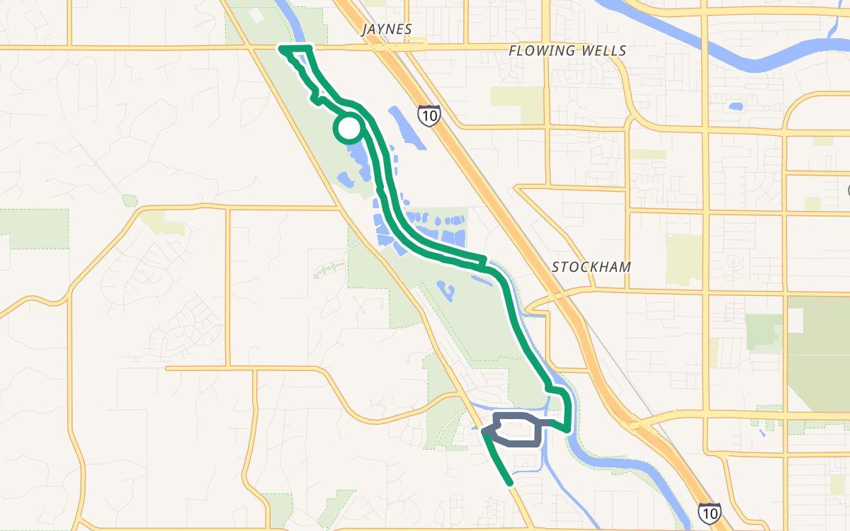
Columbus Park south on the Santa Cruz River Path
A 8.8-mile loop that starts and ends at Christopher Columbus Park, about 48 minutes at an easy pace, 100% off busy roads. The longest stretches are on The Loop (6.9 mi). 98% paved; the rest is firm gravel or dirt.
8.8 miloop
~48 minat 11 mph
100%off busy roads
87%on trails and paths
↑ 161 ftclimb
○ Start and finish: Christopher Columbus Park
Trail or pathBike laneQuiet streetBusy road
Climb along the loop: ↑ 161 ft in all
The way
- Santa Cruz River Park (The Loop)0.4 mi
- The Loop0.9 mi
- Santa Cruz River Park (The Loop)0.7 mi
- The Loop0.6 mi
- West Silverbell Tree Drive0.4 mi
- unnamed path0.8 mi
- West Silver River Way0.3 mi
- The Loop0.8 mi
- Santa Cruz River Park (The Loop)2.7 mi
- unnamed path0.3 mi
- The Loop0.7 mi
Crossings
No crossings of a busy road without a traffic light.
More Trazos we love
Brandi Fenton Park and the Rillito River Path (6.9 mi)Mercado San Agustín and the Santa Cruz (7.2 mi)Christopher Columbus Park on The Loop (4.3 mi)Reid Park and the Arroyo Chico Greenway (2.7 mi)All loops →
Loops are computed from OpenStreetMap data with Trazo's traffic-stress rating (Relaxed). They're guidance, not a guarantee: conditions change, so verify safety yourself and ride to what you see. Opening the loop in Trazo recalculates it live, with turn-by-turn directions.