Biking in Salt Lake City: common questions
Is Salt Lake City good for biking?
It has a real calm network: the paved Jordan River Parkway down the length of the valley, Parley's Trail and the 9 Line across it, and neighborhood byways on quiet streets. The hard part is the grid: blocks are long and many main streets are very wide and fast, so a short ride can mean crossing six or more lanes. Trazo plans routes that stay on the calm pieces and marks the crossings without a light.
What are some good bike rides in Salt Lake City?
Try a loop that ends where it began, almost entirely off busy roads, from a short park loop to a long day on the Jordan River Parkway. All six are on Trazos We Love.
Where can I bike with kids in Salt Lake City?
These short loops stay on paths and quiet streets, with no busy road to cross without a light. In the Trazo map, choose "With kids" and any route you plan sticks to trails and avoids busy roads almost entirely.
What is the Jordan River Parkway?
A paved trail along the Jordan River that runs north to south through the Salt Lake Valley, mostly away from traffic. It's the calmest long ride in the valley, and Parley's Trail and the 9 Line connect it to the east side.
How do I bike downtown, to Liberty Park or to Sugar House without busy roads?
These rides between places people go are almost entirely off busy roads, and each opens in Trazo with one tap. For any other start or finish, plan it in the map.
Is there a bike map of Salt Lake City?
Salt Lake City and Salt Lake County publish a bikeways map (2019 edition, PDF). Trazo's map shows the trails and lanes from current OpenStreetMap data and rates every street by how stressful it is to ride.
Is Trazo free? Do I need to download an app?
Trazo is free, with no account and no ads. It runs in your phone's browser, and you can add it to your home screen like an app. It covers Salt Lake City and the valley towns, plus other areas in Colorado, Arizona and the Carolinas.
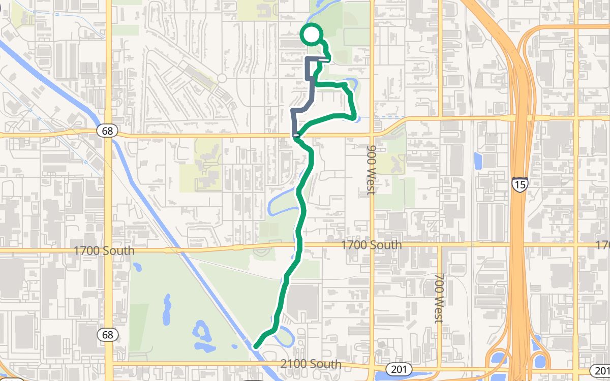 Jordan Park and the Jordan River Parkway3.7 mi · 100% off busy roads · ↑ 102 ftWith kids
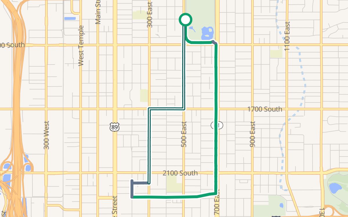 Liberty Park and the 700 East path4.6 mi · 100% off busy roads · ↑ 148 ftWith kids
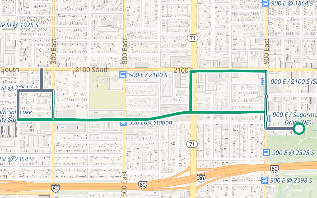 Fairmont Park, the S-Line and Parley's Trail3.3 mi · 100% off busy roads · ↑ 131 ftWith kids
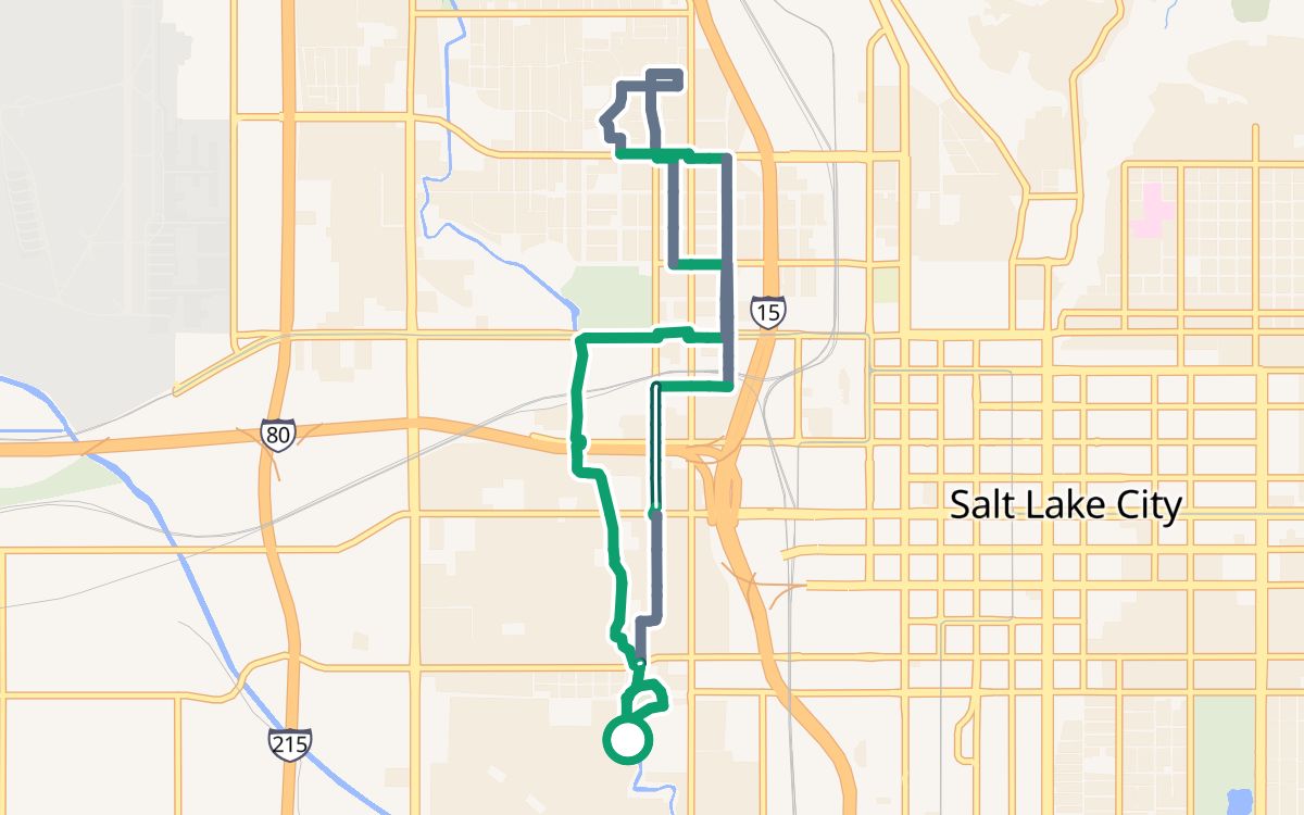 North from Jordan Park on the Jordan River Parkway8.3 mi · 100% off busy roads · ↑ 246 ftEasy and paved
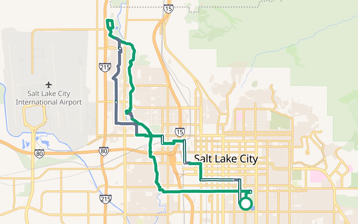 Liberty Park to the Jordan River Parkway18.2 mi · 100% off busy roads · ↑ 433 ftLonger rides
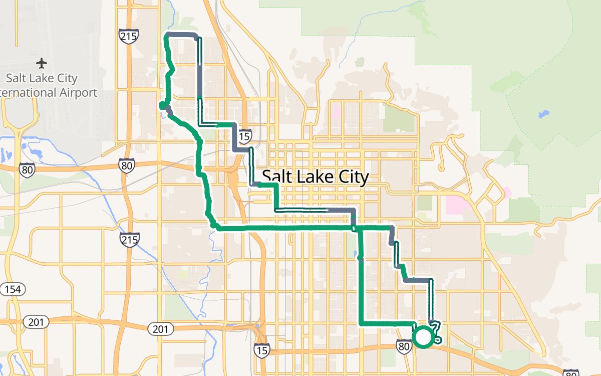 Sugar House Park to the Jordan River Parkway20.4 mi · 100% off busy roads · ↑ 748 ftLonger rides
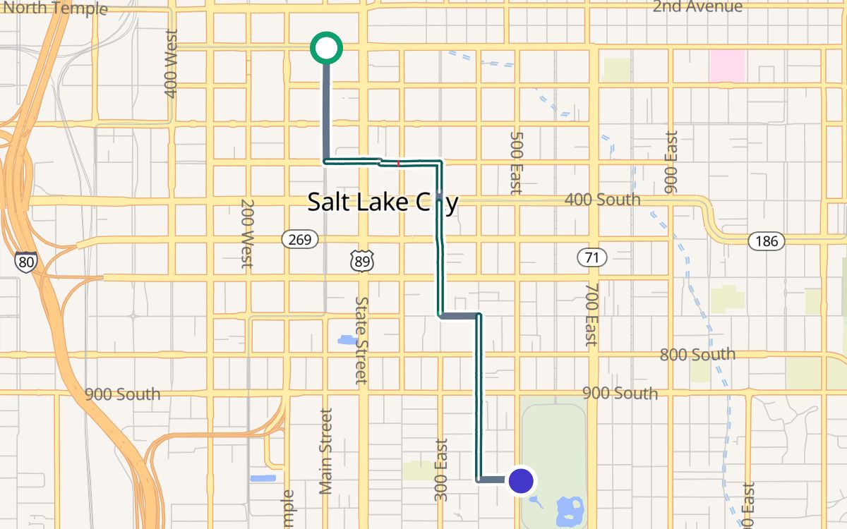 Downtown (City Creek Center) to Liberty Park2.4 mi · 100% off busy roads
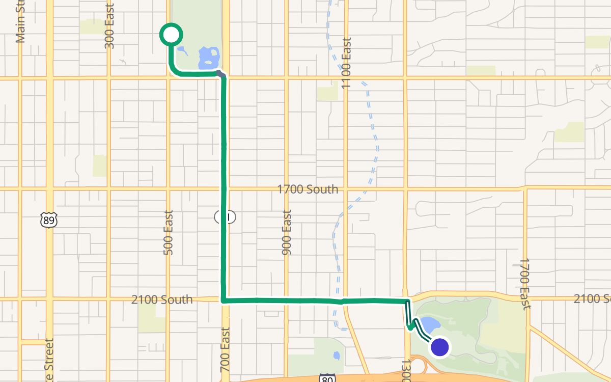 Liberty Park to Sugar House Park2.9 mi · 100% off busy roads
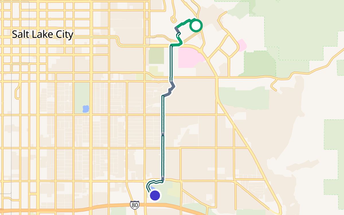 University of Utah to Sugar House Park3.9 mi · 100% off busy roads
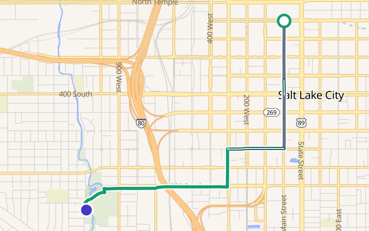 Downtown (City Creek Center) to Jordan Park3.1 mi · 100% off busy roads