Bike loops
1 calm ride that starts and ends in the same place, 7.3 miles. All loops →
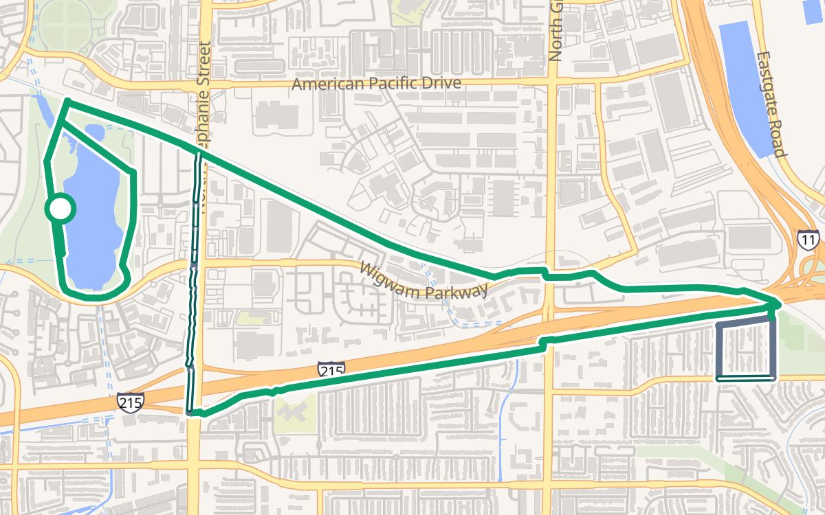 Cornerstone Park and the 215 Trail7.3 mi · ~40 min · 100% off busy roads · ↑ 233 ftEasy rides
Maps © OpenFreeMap © OpenMapTiles Data from OpenStreetMap
The River Mountains Loop circles the River Mountains on about 34 paved miles between Henderson, Boulder City and Lake Mead, and paved trails follow the Las Vegas Wash and the 215 Beltway across the valley. The hard part is the wide, fast boulevards in between. Trazo plans routes around them and flags each busy crossing that has no traffic light.
The Las Vegas valley in southern Nevada has long paved trails along its washes and beside the 215 Beltway, and the River Mountains Loop out past Henderson. Between them run six-lane boulevards with fast traffic and long blocks, so the hard part is crossing the valley, not riding the trails. Here is the backbone, and Trazo finds the calm links between the pieces.
A paved loop around the River Mountains joining Henderson, Boulder City and Lake Mead. Start from the free River Mountains Loop Trailhead lot in Henderson or the Historic Railroad Trailhead lot by Lake Mead, and carry plenty of water.
Paved paths along the Las Vegas Wash through North Las Vegas and the east side.
Paved paths beside the 215 Beltway: the Western Beltway Trail in Summerlin and the Northern Beltway Trail across the north valley.
A paved path that follows the old railroad across Henderson, near the Water Street District.
A paved path along the Pittman Wash in Henderson.
1 calm ride that starts and ends in the same place, 7.3 miles. All loops →
Maps © OpenFreeMap © OpenMapTiles Data from OpenStreetMap
Rides between places people go, mostly off busy roads. Each opens in the planner with one tap. All routes →
A paved trail of about 34 miles that circles the River Mountains, joining Henderson, Boulder City and Lake Mead National Recreation Area. It is shared with people walking and running, and parts of it are hilly.
Try the 7.3-mile easy loop from Cornerstone Park in Henderson on the Harry Reid Union Pacific Railroad Trail and the 215 Trail. See it on Las Vegas bike loops, or plan a longer ride in the Trazo map.
Pick "With kids" in the Trazo map and it favors trails like the wash and Beltway paths, then the quietest streets it can find, flagging any busy crossing without a light before you set out. We mark a ride here for kids only when it never crosses a busy road without a light and stays on trails and quiet streets; none is marked yet. The 7.3-mile Cornerstone Park loop in Henderson has no such crossing, though 11% of it is in bike lanes or on paths beside the road.
Yes on its trails: the wash trails, the Beltway trails and the River Mountains Loop are long and paved. Getting to them is harder, because most main streets are six-lane boulevards. Trazo plans routes that use the calm pieces and marks the busy crossings that have no light.
Yes. The Las Vegas map covers the whole valley, from North Las Vegas and Summerlin to Henderson, and out to Boulder City and Lake Mead along the River Mountains Loop, so a ride between them plans as one trip.
The 5.3-mile ride from the Water Street District to Cornerstone Park is 100% off busy roads, mostly on the Harry Reid Union Pacific Railroad Trail, with two crossings without a light, at West Basic Road and West Van Wagenen Street. For any other start or finish, plan it in the map.
Trazo is free, with no account and no ads. It runs in your phone's browser, and you can add it to your home screen like an app. It covers the Las Vegas valley, Henderson and Boulder City, plus other areas in Colorado, Utah, Arizona, New Mexico and the Carolinas.
Parks and neighborhoods worth a stop on your ride.
Places shown are examples on the map, not affiliated with or endorsed by Trazo.
Trazo rates every street and path by how stressful it is to ride, from its speed, lanes and bike facilities in OpenStreetMap, and plans the calmest reasonable way.
Trails, lanes and quiet streets are shaded by traffic stress, and a warning triangle marks each busy crossing with no light.
Want a 12-mile ride? Get a loop that hits your target distance and brings you back to where you started.
The map flags uncontrolled crossings: busy roads with no signal, where you cross on your own.
See the climb before you commit, and flip on “prefer flat” when you (or the kids) aren't in the mood for hills.
Search an address, drop a pin, or use your location. Or pick “Loop ride” and just set a distance.
Choose With kids, Relaxed or Anything. Trazo favors protected paths to match, and you can drag the line to add a stop.
Follow turn-by-turn with voice cues, see your elevation profile, find pit stops along the way, or export a GPX.
Drop your email and we'll tell you when saved routes, crowdsourced conditions, and new cities land.
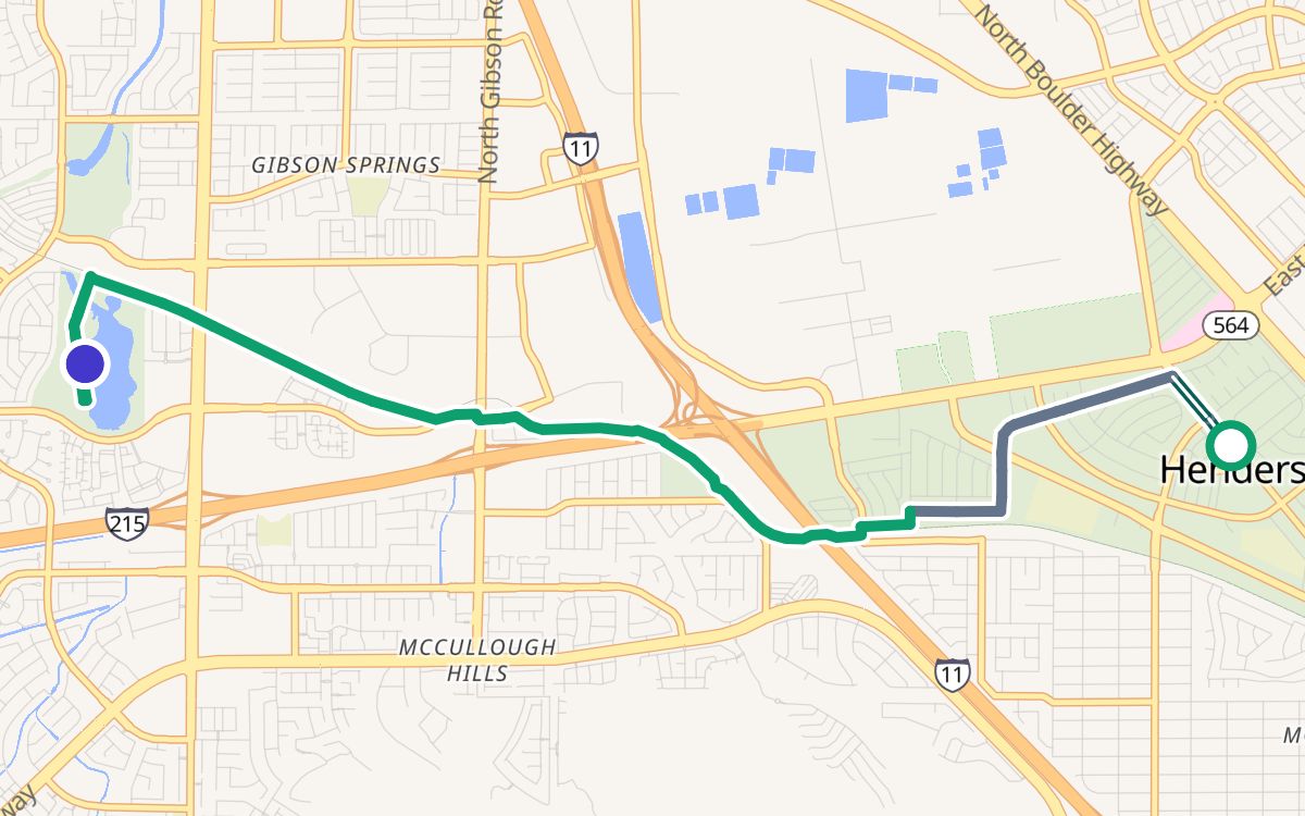 Water Street District to Cornerstone Park5.3 mi · 100% off busy roads