The City's Walnut Creek trails cross north Austin, the Brushy Creek Regional Trail runs about 11 miles from Cedar Park toward Round Rock, and Pflugerville's Gilleland Creek Trail runs 6.5 miles. The hard part is the big roads between them. Trazo plans routes and loops around them and flags the busy crossings without a traffic light that it detects.
Austin's car-free riding runs along its creeks: the City's Walnut Creek trails in the north, the Brushy Creek Regional Trail from Cedar Park toward Round Rock and Pflugerville's Gilleland Creek Trail. The trail around Lady Bird Lake downtown has several detours, one expected to last through 2033, so Trazo's first rides start elsewhere. The lengths are the trail owners' or TrailLink's.
The City's Northern Walnut Creek Trail runs 3.5 miles from Balcones District Park to Walnut Creek Metropolitan Park, then on east under Lamar Boulevard to Oakbrook Drive. It is part of a Walnut Creek trail the City plans at about 20 miles, from Balcones District Park to Govalle Park.
The trail along Brushy Creek: about 11 miles from Twin Lakes Park in Cedar Park toward Round Rock, open in two segments (TrailLink). Williamson County counts more than 6 miles in its western part, through Brushy Creek and Cedar Park.
Pflugerville's longest hike and bike trail, 6.5 miles along Gilleland Creek; up to Railroad Avenue it is also part of the Heritage Trail loop (TrailLink). Community Impact reported in February 2026 that part of it would close on February 17 for about a year while the City builds its Downtown East project, with a signed detour that adds about 0.2 miles.
The Ann and Roy Butler Hike-and-Bike Trail circles Lady Bird Lake downtown. As of November 2026, the Trail Conservancy lists a north-shore detour near the Confluence and the Austin Rowing Club through March 2027, a detour by I-35 expected to last through 2033, and the east-side crossing between the shores at I-35 closed for about a year from February 2026. Check its detours page before you ride there.
2 calm rides that start and end in the same place, from 5.0 to 6.6 miles. All loops →
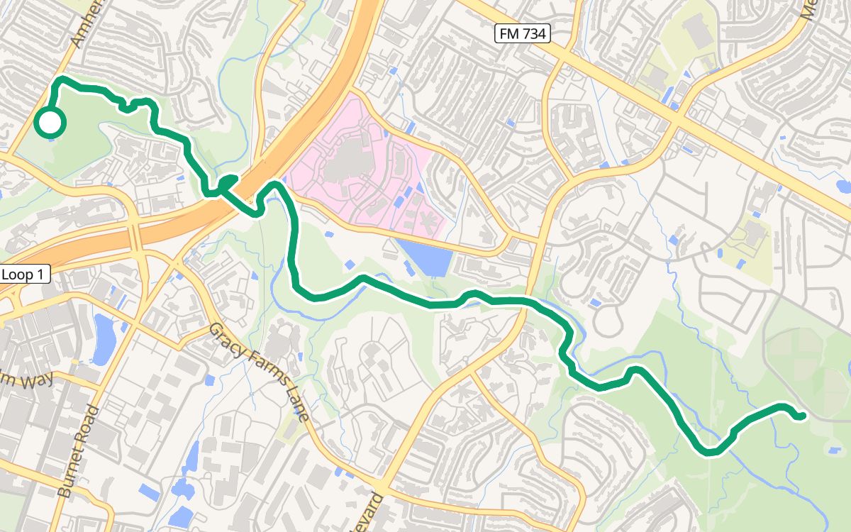
Balcones District Park to Walnut Creek Metropolitan ParkOn the Northern Walnut Creek Trail6.6 mi · ~36 min · out and back · 100% off busy roads · ↑ 272 ftWith kids
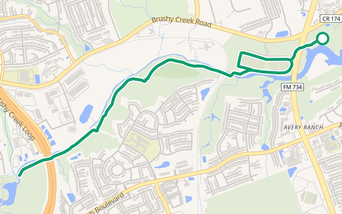
Brushy Creek Regional Trail from Brushy Creek Lake Park5.0 mi · ~28 min · 100% off busy roads · ↑ 131 ftEasy ridesMaps © OpenFreeMap © OpenMapTiles Data from OpenStreetMap
Along the creek trails: the City's Walnut Creek trails in north Austin, the Brushy Creek Regional Trail from Cedar Park toward Round Rock (about 11 miles) and the 6.5-mile Gilleland Creek Trail in Pflugerville. Trazo's first rides are on the Walnut Creek and Brushy Creek trails. Getting to them can mean busy roads, and Trazo flags the busy crossings without a traffic light that it detects.
Mostly, with detours. As of November 2026, the Trail Conservancy lists a north-shore detour near the Confluence and the Austin Rowing Club through March 2027, a detour by I-35 expected to last through 2033, and the east-side crossing between the north and south shores at I-35 closed for about a year from February 2026. Check the Trail Conservancy's detours page before you ride there.
About 11 miles from Twin Lakes Park in Cedar Park toward Round Rock, open in two segments, according to TrailLink. Williamson County counts more than 6 miles in the western part.
It runs 6.5 miles along Gilleland Creek in Pflugerville, the city's longest hike and bike trail, according to TrailLink. Up to Railroad Avenue it is also part of the Heritage Trail loop. Community Impact reported in February 2026 that part of it would close on February 17 for about a year for the City's Downtown East construction, with a signed detour that adds about 0.2 miles.
Where Trazo's Austin rides start, and bike shops near the trails.
Places shown are examples on the map, not affiliated with or endorsed by Trazo.
Trazo rates the streets and paths it routes on by how stressful they are to ride, from their road type and bike facilities in OpenStreetMap, and plans the calmest reasonable way.
Trails, lanes and quiet streets are shaded by traffic stress, and a warning triangle marks busy crossings with no light.
Pick a distance and get loops that bring you back to where you started, as close to it as the paths around you allow.
The map flags uncontrolled crossings: busy roads with no signal, where you cross on your own.
See the climb before you commit, and flip on “prefer flat” when you (or the kids) aren't in the mood for hills.
Search an address, drop a pin, or use your location. Or pick “Loop ride” and just set a distance.
Choose With kids, Relaxed or Anything. Trazo favors protected paths to match, and you can drag the line to add a stop.
Follow turn-by-turn with voice cues, see your elevation profile, find pit stops along the way, or export a GPX.
Drop your email and we'll tell you when saved routes, crowdsourced conditions, and new cities land.