Biking in Sarasota and Bradenton: common questions
What is the Legacy Trail?
The Legacy Trail is an 18.5-mile paved path on a former railroad line, from the Venice Train Depot to Fruitville Road in Sarasota (Friends of the Legacy Trail). Sarasota County runs it. It is open from 6 a.m. to sunset, the speed limit is 15 mph, and you warn before passing (county rules). Markers every tenth of a mile, like "LT 12.50", tell 911 where you are (Sarasota County). The county's Legacy Trail page has the trailhead map.
Where are the restrooms and parking on the Legacy Trail?
Sarasota County's 2026 trail brochure shows parking at the trailheads, and restrooms and water at the Venice Train Depot, Patriots Park, Nokomis Community Park, Laurel Park, Osprey Junction, Culverhouse Nature Park, the Ashton, Sarasota Springs and Pompano trailheads, Payne Park, and Oscar Scherer State Park, which charges an entry fee. Bike repair stations are at the depot, Laurel Park, Osprey Junction, Ashton, Sarasota Springs and Pompano.
How does the Legacy Trail cross the busy roads?
It goes over US 41 in Venice, Laurel Road, Clark Road and Bee Ridge Road on bridges, and under State Road 681. The Clark Road and Bee Ridge Road bridges opened in summer 2025 (Florida Department of Transportation, FDOT). At other roads it crosses at traffic signals, stop signs, flashing beacons, or push-button signals that stop traffic for people crossing, called HAWK beacons (Sarasota County). Trazo flags the busy crossings where map data shows no traffic light, and map data can miss a light.
Does the Legacy Trail reach downtown Sarasota and Benderson Park?
It reaches the east edge of downtown, running past Payne Park to its end at Fruitville Road. Nathan Benderson Park has its own paths, but a trail from the Legacy Trail to it isn't finished yet. Farther east, a separate half-mile connector from the trail at Beneva Road north to Fruitville Road opened in March 2026, and in October 2026 county commissioners approved more than $3 million for a link of about two miles toward Nathan Benderson Park, which a commissioner said should be done over the next year (WWSB, ABC7 Sarasota). North of Fruitville, the city's Circus Trail is cracked in places, and the city plans to realign it, with construction set for FDOT's 2028 to 2029 budget year (Your Observer). As of November 2026.
What are some good bike rides in Sarasota and Bradenton?
Trazo has 4 rides here, all south of Sarasota and all off busy roads. With kids: 7.8 miles from the Venice Train Depot to Shamrock Park and back on the Venetian Waterway Trail, and 5.1 miles on the North Port Connector from the West Price Boulevard trailhead, both all on trail. Easy rides: 5.1 miles from the Venice Train Depot to Laurel Park and back on the Legacy Trail, and 8.5 miles from Osprey Junction to Laurel Park and back, through Oscar Scherer State Park. The depot, Laurel Park and Osprey Junction have restrooms, water and a bike repair station, and Shamrock Park has restrooms (Sarasota County). Trazo detected no busy road to cross without a traffic light on any of them. Sarasota has no ride page yet while we finish checking its trail crossings, and Bradenton has none yet. See them all on Sarasota and Bradenton bike rides.
Where can I bike with kids in Sarasota?
The 7.8-mile ride from the Venice Train Depot to Shamrock Park and back, along the Intracoastal Waterway on the Venetian Waterway Trail, is all on trail and has restrooms at both ends (Sarasota County), and Trazo detected no busy road to cross without a traffic light. In the Trazo map, choose "With kids" and Trazo favors trails and avoids busy roads where it can. Check every route yourself.
Can I ride an e-bike on the Legacy Trail?
Yes. Sarasota County treats e-bikes like bicycles on the Legacy Trail and in its parks: working pedals, 15 mph at most (county rules). Under Florida law an e-bike has working pedals, a seat and a motor under 750 watts, and its help stops at 20 mph (classes 1 and 2) or 28 mph (class 3, which helps only while you pedal). One with more power or no working pedals may count as a motorcycle (Venice police). Local rules differ: unincorporated Manatee County bars riders under 16 from class 3 e-bikes, and Holmes Beach bans e-bikes on its sidewalks. As of November 2026.
Can I ride on the sidewalk in Sarasota?
Florida law lets you ride on sidewalks with a pedestrian's rights and duties: yield to people walking and give an audible signal before you pass (section 316.2065). Some places say no: downtown Venice bans riding on the sidewalks of Venice, Tampa and Miami Avenues between the Tamiami Trail (Business 41) and Harbor Drive, and of Nokomis Avenue and Nassau Street between Tampa and Miami Avenues, so you walk your bike there (City of Venice). Bradenton bans riding on the sidewalks of Old Main Street (1st to 6th Avenues West) and 12th Street West (9th to 13th Avenues West), and caps it at 15 mph on other sidewalks and 10 mph on the Riverwalk and the downtown and Village of the Arts sidewalks (City of Bradenton, Ordinance 3092). Holmes Beach bans e-bikes on its sidewalks.
Do I need a helmet or lights to ride in Florida?
Riders and passengers under 16 must wear a helmet. From sunset to sunrise you need a white front light seen from 500 feet, and a red rear light and red rear reflector seen from 600 feet. Drivers must pass a bicycle with at least 3 feet of room (Florida Statutes, sections 316.2065 and 316.083).
When is the best time to ride, and what about heat and storms?
Fall through spring. From June to September, normal highs at the Sarasota-Bradenton airport are about 90 to 92°F (NOAA, 1991 to 2020 normals), and the rainy season brings frequent thunderstorms and lightning from about mid-May to mid-October (National Weather Service). Hurricane season runs from June 1 to November 30. The Legacy Trail closes at sunset.
Can I bike in Myakka River State Park?
Yes. The park has seven miles of paved road that you share with cars, and dirt roads in the backcountry that can be sandy, rutted or flooded in summer. It is open from 8 a.m. to sunset, and bikes pay $2 to enter. Since October 2025 the park has said drinking water is temporarily unavailable, and bottled water is free at the ranger station (Florida State Parks). As of November 2026.
Is Sarasota safe for biking?
Busy roads are the danger. A law firm's study of federal crash data ranked Sarasota and Manatee counties second and third among the 200 largest US counties for cyclist deaths per resident in 2017 to 2021 (The Guardian, 2024), and Sarasota police name stretches of US 41, US 301 and Fruitville Road among their high-crash areas (2026). Trazo plans around busy roads where it can and flags the busy crossings without a traffic light it detects. It can't make a road safe, so check every route yourself.
Is Trazo free? Do I need to download an app?
Trazo is free to use, and you don't need an account. It runs in your phone's browser, and you can add it to your home screen like an app. It covers Sarasota and Bradenton from Venice and North Port to Palmetto and Anna Maria Island, plus other areas in Colorado, Utah, Arizona, Nevada, New Mexico, California, Texas and the Carolinas.
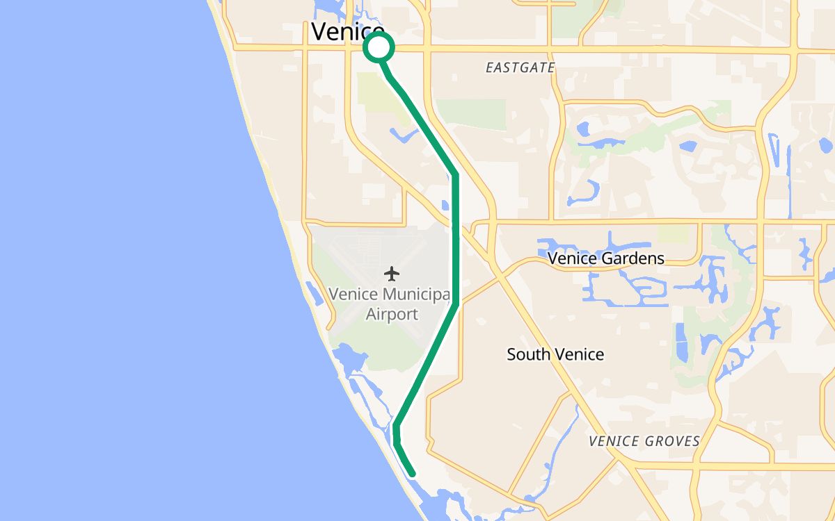 Venice Train Depot to Shamrock ParkOn the Venetian Waterway Trail · restrooms at both ends7.8 mi · ~42 min · out and back · 100% off busy roads · ↑ 36 ftWith kids
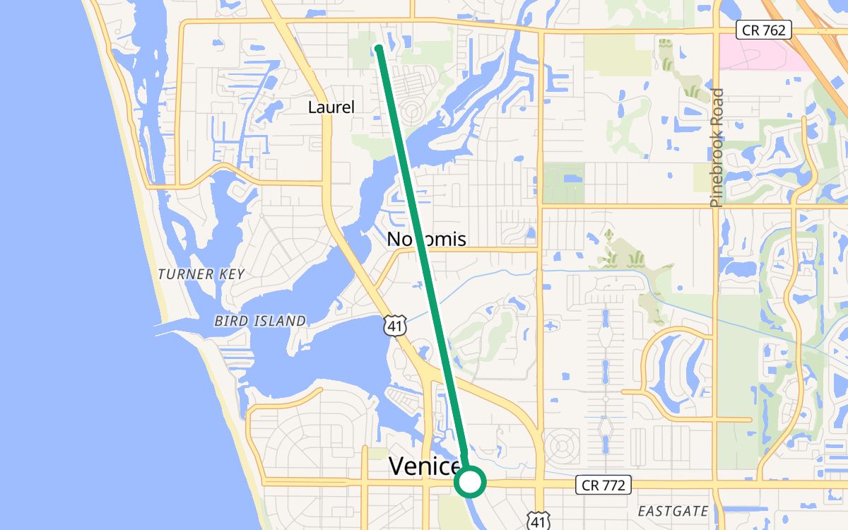 Venice Train Depot to Laurel ParkOn the Legacy Trail · restrooms and water at both ends5.1 mi · ~28 min · out and back · 100% off busy roads · ↑ 26 ftEasy rides
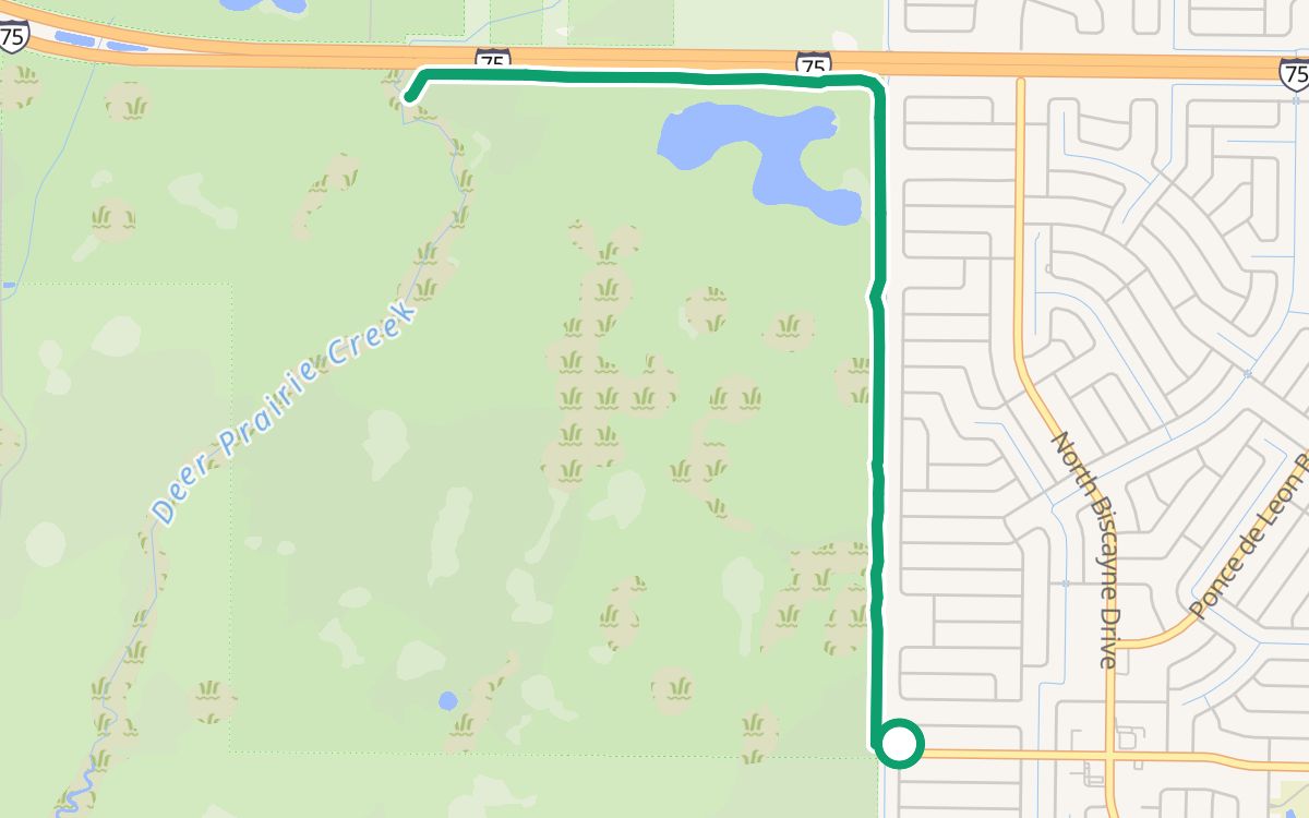 North Port Connector from West Price BoulevardOn the Legacy Trail North Port Connector5.1 mi · ~28 min · out and back · 100% off busy roads · ↑ 13 ftWith kids
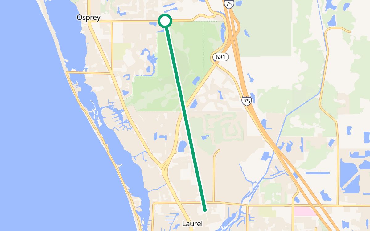 Osprey Junction to Laurel ParkOn the Legacy Trail · restrooms and water at both ends8.5 mi · ~47 min · out and back · 100% off busy roads · ↑ 30 ftEasy rides